 |
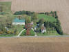
Hartsough Farm, 1 mile south of N.
Manchester. |
 |
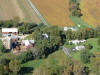
Gross-Kindy Farm, 1 mile east of Liberty
Mills. |
 |
Briarwood, northwest of SR 13. |
 |
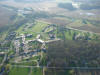
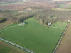
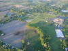
Manchester College Athletic Fields by the
Eel River (Kenapocomo). |
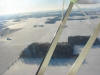 |
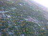
Wintry Scene. |
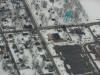 |
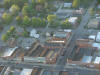
Market and 9th Streets; Warvel Park and
water tower at upper right. |
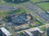 |
MC Student Union, newly remodeled. |
 |
Timbercrest. East Street at bottom, SR 13 at
top. |
 |
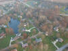
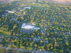
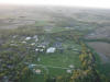
Country Residences. |
 |
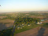
Facing East towards Liberty Mills. Site of
former covered bridge and Comstock farm. |
 |
Looking North to Main Street from above N.M.
covered bridge. |
 |
Intersection Mill and Main Streets. CVS on
right. |
 |
Intersection Main and Walnut Streets at
bottom. Post Office and Old Sheller Hotel on
Second Street. |
 |
Main and Elm Streets. Grandstaff-Hentgen
(Bender) Funeral Service. Old library at right. |
 |
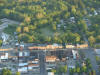
Frantz Lumber Co. |
 |
Pizza Hut and Shopping Center. Former site
of N.M. Airport. |
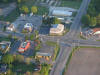 |
Intersection SR 114 and SR 13. McDonalds,
Harting Furniture, Butterbaugh One-Stop, Cripe
Farm. |
 |
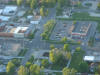
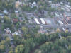
Industrial Park, upper right. Shopping
Center and Mobile Home Park. |
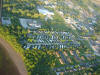 |
Strauss-Provimi, Jamestown Apartments,
mobile homes. |
 |
Formerly Peabody Factory, alongside
railroad. |
 |
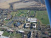
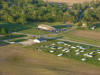
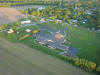
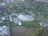
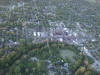
MCS Junior High and High Schools,
Recreational Fields. |
 |
Heckman Bindery (HF Group); Manchester
College at upper left; Eel River at top. |
 |
Facing South. Main Street at center. |
 |
Above Walnut Street looking South. Main
Street. Market Street on right. |
 |
Main Street at right middle. Methodist
Church. |
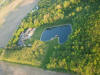 |
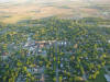
Wooded estate on Meridian Road. |
 |
Briarwood Subdivision beside railroad. |
 |
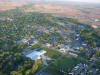
Intermediate School, Laketon. |
 |
Looking East. Intersection SR 114 and SR 13
at bottom. |
 |
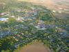
Peabody Retirement Community and Oaklawn
Cemetery on left. SR 114 and SR 13 at bottom. |
 |
Railroad on left; Eel River on right; Public
Safety Building with green roof. |
 |
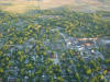
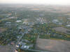
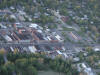
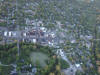
Downtown North Manchester alongside the Eel
River. |
 |
Intersection Market and Main Streets. Zion
Lutheran Church and bridge. |
 |
Main Street with Walnut and Mill Streets.
Eel River at bottom. |
 |
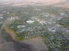
Downtown North Manchester. Market Street.
River bend. |
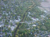 |
SR 114 crossing Eel River east of downtown
business district. |
 |
Downtown North Manchester.
Main-Market-Walnut-Mill Streets. |
 |
Looking North. MC campus. East Street
crossing SR 13. Eel River on right. |
| |
|
| |
|